Another round of severe weather swept through the Ohio Valley yesterday, resulting in another tornado warning that encompassed Brown and Clermont counties. Recall that Clermont County received a tornado warning last Monday, though it has been about a month since Brown Count received its last tornado warning on June 29th. There was no confirmed tornado with this storm.
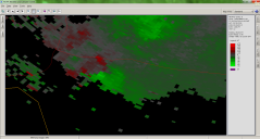
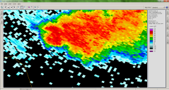
Below is an image of storm base reflectivity and storm base velocity taken from KILN (NWS Wilmington’s radar) just prior to the warning being issued. The warning text says that “AT 816 PM EDT…RADAR INDICATED A SEVERE THUNDERSTORM CAPABLE OF PRODUCING A TORNADO OVER AMELIA…MOVING SOUTHEAST AT 20 MPH”, so I am assuming that they were going off of radar imagery from the TCVG radar, located at the Cincinnati/Northern Kentucky International Airport. NCDC will not release those images for a few more days, so I just posted KILN’s.
* The confirmed tornado in Green County occurred with neither a severe thunderstorm warning, nor a tornado warning.
** The confirmed tornado in Washington County occurred with neither a severe thunderstorm warning nor a tornado warning. The two warnings that were issued for Washington County were issued during storms that occurred on April 9th.
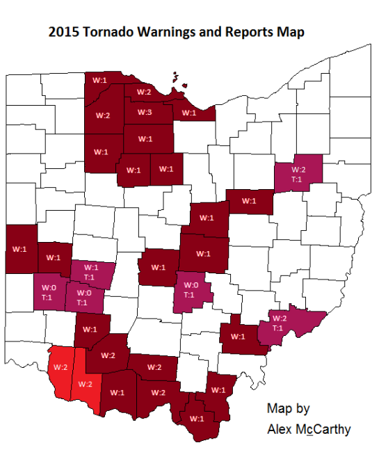
*** This map is made to highlight Ohio counties that have had tornado warnings issued and counties that have had confirmed tornado touchdowns in the 2015 calendar year. Shades of red indicate counties that have had tornado warnings yet have had no confirmed tornado touchdowns yet. Shades of purple indicate counties that have had confirmed tornado touchdowns. In both cases, the bright colors indicate the newest add-ons to this map and are usually the counties mentioned in the discussion above. Darker shades, on the other hand, are used for counties that have had no change in their 2015 tornado statistics. As a second feature, counties that have experienced warnings or touchdowns also have numbers coinciding to the number of tornado warnings and touchdowns. The number that follows a “W” is the number of warnings the county has received, and the number that follows the “T” is the number of confirmed touchdowns that there have been. It is important to remember that each warning issued is counted. If there is a tornado warning on a storm in Stark county, and a second warning is issued for Stark on the same storm, then Stark county would be considered to have two warnings despite there only being one tornadic storm. Likewise, if a single storm drops numerous tornadoes, each tornado will be counted as an individual tornado.


